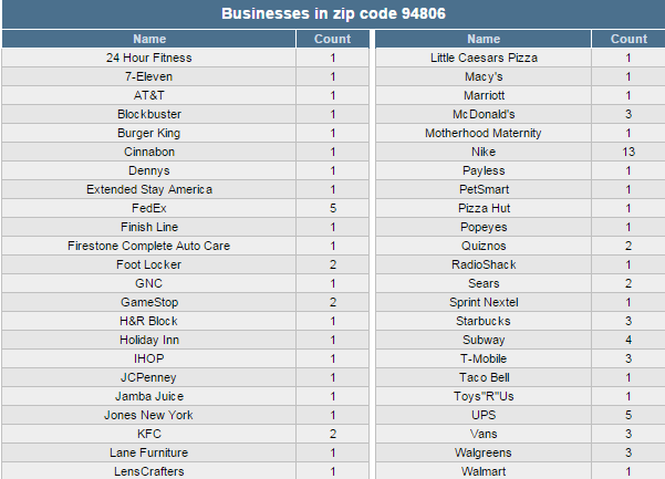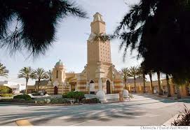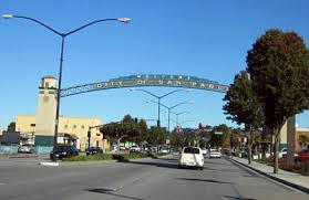
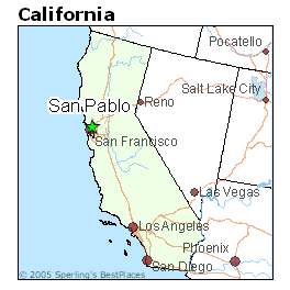
San Pablo, Contra Costa County, CA 94806
Cities: Richmond, CA (49.83%), San Pablo, CA (28.93%), Tara Hills, CA (7.46%), Montalvin Manor, CA (3.99%), Rollingwood, CA (1.94%), Pinole, CA (1.64%), North Richmond, CA (0.04%)
County: Contra Costa County, CA
Estimated zip code population in 2011: 59,944
Zip code population in 2010: 59,861
Zip code population in 2000: 55,719
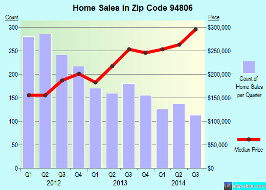
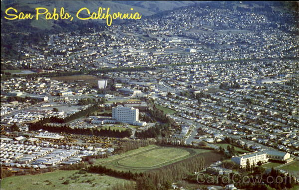
Recent home sales, real estate maps, and home value estimator for zip code 94806
Houses and condos: 20,785
Renter-occupied apartments: 8,970
| % of renters here: | 47% |
| State: | 45% |
Mar. 2012 cost of living index in zip code 94806: 130.7 (high, U.S. average is 100)
Land area: 8.3 sq. mi.
Water area: 0.2 sq. mi.
| Population density: 7,192 people per square mile |
|
(high). |
Real estate property taxes paid for housing units in 2011:
| This zip code: | 0.8% ($2,687) |
| California: | 0.8% ($2,907) |
Median real estate property taxes paid for housing units with mortgages in 2011: $3,011 (0.9%)
Median real estate property taxes paid for housing units with no mortgage in 2011: $1,459 (0.5%)
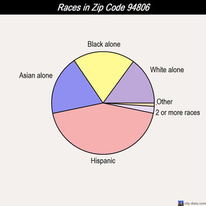
Races in zip code 94806:
|
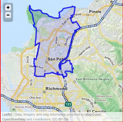
Neighborhoods in zip code 94806:
Percentage of zip code residents living and working in this county: 48.5%