Redwood City
红木城是美国加利福尼亚州旧金山湾区里的一个城市,位于旧金山湾区西边、旧金山半岛的东岸,也是圣马刁县的县府所在地。根据2000年的人口普查,红木城共有居民7.5402万人。红木城拥有旧金山湾里旧金山以南唯一的深水港。
| ZIP codes | 94059, 94061–94065 |
|---|
Redwood City is a city on the San Francisco Peninsula in Northern California’s Bay Area, approximately 27 miles (43 km) south of San Francisco, and 24 mi (39 km) north of San Jose. Redwood City’s history spans its earliest inhabitation by the Ohlone people to being a port for lumber and other goods. The county seat of San Mateo County, it is the home of several technology companies such as Box (company), Oracle, Evernote, Wealthfront,[8] and Electronic Arts. At the 2010 census, the city had a population of 76,815. The Port of Redwood City is the only deepwater port on San Francisco Bay south of San Francisco. Redwood City is the location of the San Mateo County Jail, for both women and men. The Malibu Grand Prix long time landmark was recently demolished along with the city’s only Mini Golf, Go-Kart, Video Game Arcade, and Batting Cages. Malibu Grand Prix’s previous location is currently the construction site of a new additional Jail and Inmate housing facility. The city has a motto “Climate Best By Government Test” which is a reference to it being one of the top German scouted scientific climates and the city was one of the locations mapped by them during their testing and data collection. The Hetch Hetchy water pipeline runs through Redwood City and supplies a vast majority of the surrounding area with low grain (+/− 3 grains) rated water.
According to the United States Census Bureau, the city has an area of 34.7 square miles (90 km2), of which 19.4 square miles (50 km2) is land and 15.2 square miles (39 km2) (43.91%) is water. A major watercourse draining much of Redwood City is Redwood Creek, to which several significant river deltas connect, the largest of which is Westpoint Slough.
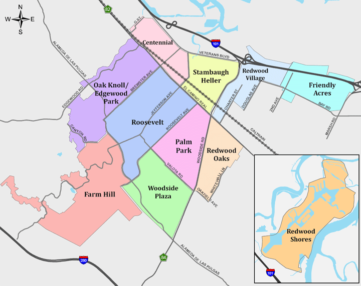
Redwood City’s sphere of influence includes the districts of Emerald Lake Hills and North Fair Oaks, which, however, are largely outside the city boundaries and are counted individually for the U.S. census. Palomar Park, just north of Emerald Hills and east of San Carlos’ Crestview area, is another Redwood City neighborhood that is formally part of unincorporated San Mateo County. The northern neighborhood of Redwood Shores is part of Redwood City, although it is not possible to travel by road from one to the other without passing through the neighboring city of San Carlos, or through Belmont via unincorporated San Mateo County. Although Redwood City has a large middle class, the south eastern section of Redwood City highly resembles working class North Fair Oaks in demographic make-up and income level.
El Camino Real, a northwest/southeast arterial street and Woodside Road, a north-northeast/south-southwest arterial, run through Redwood City. Locally, the former is regarded as north/south and the latter east/west, as El Camino connects Redwood City to San Francisco and San Jose and Woodside Road runs from San Francisco Bay to the Santa Cruz Mountains. The actual geography is as stated.
Redwood City is a heavily developed mixed city, from its huge dense urban in the east, north, northeast and central neighborhoods, to its very dense suburban in the west, south and central-south neighborhoods, to its less dense exurb in the deep south and south-west neighborhoods, and to its rural upscale hillside neighborhoods. It is a very diverse cosmopolitan city in the Bay Area, a newly popular destination in the peninsula and the Bay as a whole