South San Francisco-北加州华人热门城市排行榜 23 of 30
South San Francisco is a city in San Mateo County, California, United States, located on the San Francisco Peninsula in the San Francisco Bay Area. The population was 63,632 at the 2010 census.
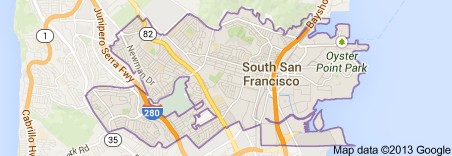
South San Francisco lies north of San Bruno and San Francisco International Airport in a small valley south of Daly City, Colma, Brisbane, and San Bruno Mountain, east of Pacifica and the hills of the Coast Range, and west of the waters ofSan Francisco Bay. Locals often refer to the town as “South City,” in much the same way that San Francisco is called “The City.” People unfamiliar with the area often mistake “South San Francisco” as the southern part of the city of San Francisco. In fact, the city of South San Francisco is not even contiguous with the city of San Francisco, due to the city of Brisbane being between them.
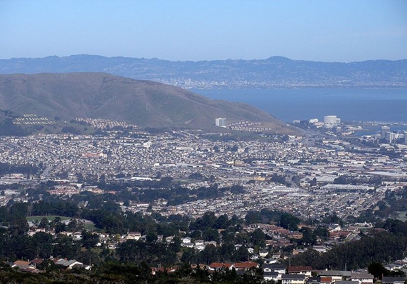
Most of the valley faces San Francisco Bay, affording bay views from higher levels. South San Francisco has mild winters and dry cool summers. The hills to the west shield the city from much of the fog that prevails in neighboring areas.
The population has tripled since World War II with the opening of such subdivisions as Buri Buri, Winston Manor and Westborough on the slopes west of El Camino. It has grown from 4,411 in 1920 to 61,824 in 2006. As of the last Census and the published results in 2011, the population of South San Francisco stands at 64,409.
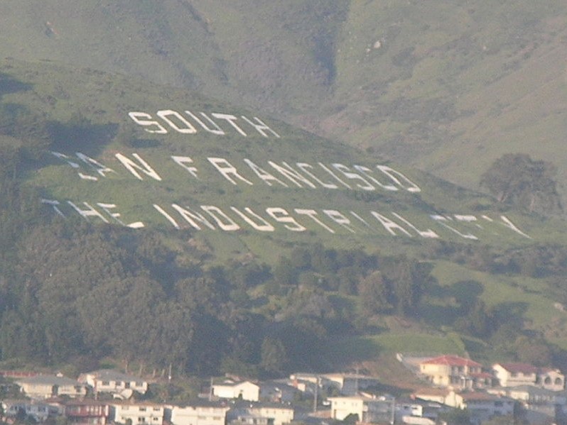
The city is noted for the South San Francisco Hillside Sign on Sign Hill, which rises to the north of the city, with large white letters that proclaim “South San Francisco, The Industrial City”. The sign, a tribute to the city’s industrial past, is listed on the National Register of Historic Places.
History
The area which is now South San Francisco was originally part of Rancho Buri Buri, a large Mexican land grant dating to 1827. In 1853 Charles Lux and a business partner, Alfred Edmondson, purchased 1,700 acres (7 km2) of Rancho Buri Buri. Lux bought out Edmonson’s interest in 1856 and founded the town of Baden, now a neighborhood of South San Francisco. In 1855 Lux bought another 1,464 acres (6 km2) of Rancho Buri Buri land and became a partner of fellow San Francisco butcher and entrepreneur Henry Miller, forming the firm of Miller & Lux.
The city of South San Francisco was originally conceived as an industrial suburb and was promoted by representatives of the Beef Trust, a group including some of the country’s largest meat packing firms. A city plan was put forward in 1888 by Gustavus Franklin Swift, founder of the Swift & Company meat packing firm. The plan called for multiple individual meat-packing companies with a shared stockyard, as well as a residential area for employees. Swift proposed the name South San Francisco based on South Chicago and South Omaha, where the Swift company already had plants.
In 1890 Peter E. Iler of Omaha, Nebraska, an agent of the Beef Trust, purchased Lux’s property, and in 1891 ownership was transferred to the South San Francisco Land and Improvement Company. The area was divided into industrial and residential districts and the company installed lighting, sewer connections, and water distributions in the residential areas. A second corporation, eventually known as the Western Meat Company, set up stock yards and meat packing facilities on 80 acres (32 ha) of bayfront property; the facility opened in 1892. Other industries soon moved in, including a pottery works, two brick companies, the paint manufacturer W.P. Fuller & Company, the South San Francisco Lumber Company, and the Pacific Jupiter Steel Company.
The city of South San Francisco was incorporated in 1908 following a dispute with San Mateo County, which had blocked the construction of a smelter on San Bruno Point which was supported by the locals. Following incorporation additional industries moved into the town, including two steel mills. A new City Hall was opened on November 11, 1920.
By the 1920s the city was “the smokestack capital of the Peninsula.” South San Francisco proudly called itself “The Industrial City”, a motto immortalized in 1923 by a huge sign on a hillside overlooking the city. Industry remained the city’s main economic focus through the 1950s. During the depression the city maintained 35 industrial operations, including four meat-packing businesses, six iron or steel plants, a smelter for precious metals, seven equipment manufacturers of various kinds, two large paint factories, three other chemical works, and three food packing establishments. During World War II shipbuilding also became a significant operation.
At the end of the war the city’s focus shifted away from “smokestack industries” toward light industry, warehousing, and residential development. The major manufacturers closed, and new development was focused on office parks, housing, high-rise hotels, and yacht harbors. The biotechnology giant Genentech opened in 1976, leading to South San Francisco’s new identity as “the birthplace of biotechnology”.The population grew to 63,632 as of the 2010 census.
Transportation
South San Francisco is adjacent to the San Francisco International Airport (SFO). A BART station, located directly adjacent to El Camino High School and Solaire Transit Village, provides rapid transit service to SFO, the city of San Francisco, and the East Bay. BART supplements the older Caltrain service to San Francisco and San Jose. Caltrain’s station is adjacent to downtown on Grand Avenue.
On June 4, 2012, the Water Emergency Transportation Authority began a ferry service between Oyster Point Marina and the east bay cities of Oakland at Jack London Square and Alameda at the Main Street ferry terminal. The ferry service operates during weekday commute hours only.
The city is served by two major north-south freeways, U.S. Route 101 (the Bayshore Freeway), along the San Francisco Bay, and Interstate 280, along the hills of the Santa Cruz Mountains.